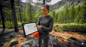
Forestry projects in Utah require precise tools to manage vast landscapes, protect ecosystems, and balance human needs with natural resources. Traditional methods often fall short when dealing with diverse terrains, unpredictable weather, and sensitive habitats. To address these challenges, many professionals now turn to specialized GIS services designed for forestry applications.
Geographic Information Systems in Utah provides the technology to collect, analyze, and interpret spatial data that guides forestry management. By combining technology with environmental stewardship, these services transform how forestry projects are designed and executed. This article will highlight five major benefits of GIS applications for forestry initiatives across the state.
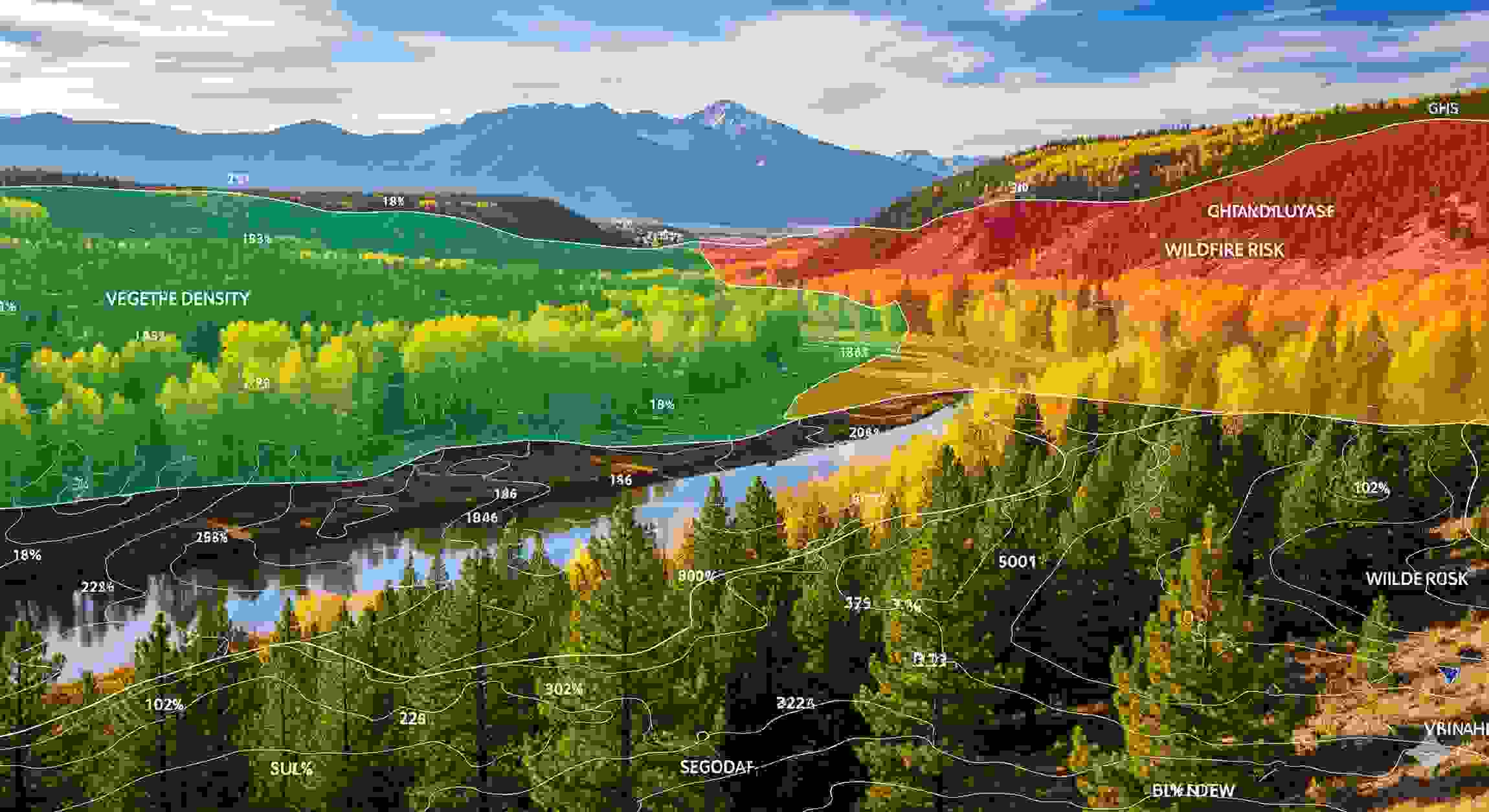
Accurate Tree and Vegetation Assessment
Precise information about tree conditions is essential when managing forests. GIS services in Utah deliver reliable data on tree density, canopy coverage, and areas where vegetation appears stressed. Early detection of unhealthy zones allows for quick intervention before problems spread across larger regions.
High-resolution imagery combined with mapping tools provides a clear picture of plant health. By understanding density patterns, professionals can balance growth with available resources. This ensures healthier forests capable of supporting both wildlife and environmental stability. Such insights make long-term forest management more reliable and effective.
Improved Wildfire Risk Analysis

Wildfires remain one of the most significant threats to forests in Utah. GIS technology identifies high-risk areas by mapping underbrush, slopes, and dry vegetation concentrations. This information allows managers to prioritize treatment zones and reduce the chance of severe fire damage.
With this data, land stewards can design targeted fuel reduction strategies that focus on the most vulnerable areas. Such planning protects forests and also safeguards nearby communities from potential devastation. Over time, these efforts create healthier ecosystems that are far more resistant to destructive wildfires.
Enhanced Wildlife Habitat Management
Healthy forests sustain countless species, from large mammals to migratory birds. GIS services in Utah track vegetation cover, migration routes, and open areas essential for biodiversity. These insights enable land stewards to balance human needs with ecological protection.
Habitat mapping ensures that food, shelter, and safe pathways remain available for animals. Clear data highlights areas where conditions should be improved or preserved. By supporting wildlife, forests retain their natural balance and long-term resilience.
Better Land Use Planning and Infrastructure Support
Forestry projects in Utah often overlap with roads, trails, and land development efforts. GIS tools reveal terrain details that help in planning new access routes or protecting existing pathways. These insights prevent costly mistakes by highlighting challenges such as erosion-prone slopes or unstable soils.
Property stewards benefit from detailed visual records of their land. These records assist in making decisions that combine conservation with responsible development. With reliable mapping, land-use planning becomes both more efficient and environmentally sound.
Streamlined Data Sharing and Collaboration
Forestry projects involve many stakeholders, including scientists, landowners, and government agencies. GIS services make it easier to share maps, reports, and spatial data across multiple groups. This level of collaboration ensures everyone has access to the same accurate information.
When data is centralized, decisions are made faster and with greater confidence. Interactive maps also improve communication between different parties working on the same land. The result is smoother cooperation and stronger project outcomes. This unified approach helps align goals, reduce conflicts, and ensure that every action taken supports long-term forestry success.
GIS services have become indispensable for forestry initiatives by improving data accuracy, planning efficiency, and environmental protection. The integration of Geographic Information Systems in Utah into forestry projects allows for smarter decisions that preserve natural landscapes while supporting economic objectives. As forestry challenges are changing, these tools provide the clarity and foresight needed to manage resources responsibly. This integration of technology and environmental stewardship ensures forests remain productive, resilient, and valuable for future generations.